
Drain Mapping Services
Drain Mapping
Know how your site drainage works
Knowing how your site drainage network functions and being able to easily identify flow paths and duty type is essential. Pollution guidelines stipulate that sites should not only know this information but that it should be displayed and understood by spill responders.
A drain map must be accurate and up to date. It’s use is critical in the event of a spill or in the event of a fire. An accurate drain map enables appropriate responses and actions as opposed to the risk of initially unknown environmental damage.

Drain Mapping determines the location and depths of sewer, foul water and rainwater drains on your site.
Drain Mapping should always be a key information component for site management within the Environmental Management System.
Where sites have high risk and in particular COMAH and EPR Regulated sites accurate Drain Mapping is fundamental to site compliance.
Book A Free Consultation
Book a free consultation today to learn more about how Aquasentry’s extensive range of products and services can help you remain safe, ensure compliance with legislation and help maintain your pollution prevention assets.
Services Available
Drainage Scale Drawings
Accurately plotted site drain plans
Drain Connectivity Surveys
Plans for manhole connectivity and flow paths
Drain Flow Path Modelling
Modelling that combines our full CCTV and GPS surveys

Drainage Scale Drawings
Clearly reference manholes, chambers and points
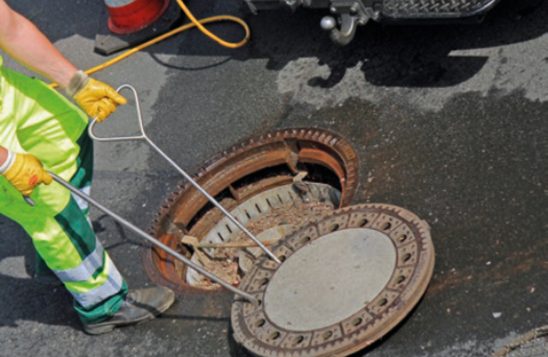
When undertaking a site drainage CCTV survey a critical component is to work from an asset referenced site drawing. This drawing must have clearly referenced manhole and chamber identifications, drain points which must be physically identifiable on site and be clearly and accurately referenced and plotted onto the site drain plan.
The most accurate method of producing a drain plan that identifies and records above ground drain asset is to use GPS to accurately record the drain points co-ordinates. These above ground points are input into the drawing software and these are then connected to indicate the drain pipework. Typically we will colour code the pipework on the drawing to visibly indicate the duty (storm, foul or effluent) and include a direction arrow to show the flow.
Where a GPS survey is combined with a CCTV survey we can deliver critical accuracy of your site drainage connectivity. In the event of a spill the drains can fill with pollutants and provide a pathway for the pollutants to enter the watercourses. Having the information on your site drain connectivity readily available enables appropriate control actions to be taken. This information can also be incorporated in more complex site baseline models used with our spill and firewater incident containment assessments.
Drain Connectivity Surveys
Basic manhole connectivity and flow
A connectivity survey is an entry level survey providing sites with a basic site drainage plan to provide an overview of manhole connectivity and flow paths.
The survey requires the client to provide a site drainage plan with visibly identified manholes. As part of our service we lift the covers and by means of visible inspection identify the duty as well as using acoustic methods to identify any connecting manholes.
The manholes will be referenced on completion of the survey which can then form a basis for any future CCTV surveys and/or a full GPS and scaled drain plan.
We advise that this type of survey is used as a first interim step to completing a comprehensive drain plan and that its accuracy can only be fully validated with a CCTV survey where all connectivity and condition can be identified and recorded.
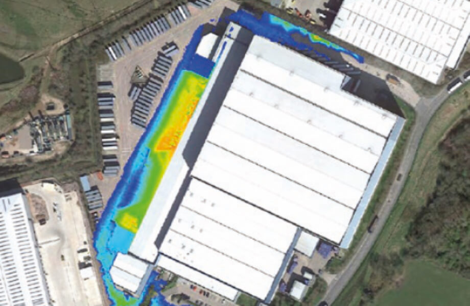
Drain Flow Path Modelling
Combined CCTV, GPS, and topography modelling
The type of modelling combines our full CCTV and GPS surveys with additional site GPS topographical information which links into hydraulic modelling software to establish effects of specific conditions on a site. Developed to enable sites to meet the recommendation of Ciria C736 – Containment Systems for the Prevention of Pollution this type of modelling reproduces the impact of primary containment failure, weather events and firewater on a site.
This modelling enables evidenced containment solutions to be applied to a site and then for the most cost-effective solution to be established, designed and delivered.
This high-level approach continues to engage and satisfy requirements of the EA, SEPA and the HSE in their drive to ensure appropriate environmental protection. At the same time our clients have the knowledge that any site work required is a justifiable investment in maintaining their objectives and obligations and in protecting the environment.
When a client has a requirement for Firewater Containment and a need for pollution control devices to be installed we recommend that this modelling process is considered to ensure that the full impacts of closing a drain are known and evidenced.
Testimonials
“I’ve been fortunate to work with AquaSentry for approximately 2 years. In this time I have dealt with a number of employees and they all have the same attributes their professionalism and attention to detail are excellent.”
Jamie Meadows
Meadow Foods
Enquire Now
If you’re interested in discovering how we can help protect your business with our range of products and services, fill in the form and a member of our team will get in contact with you to discuss further.